Listen to the article
Satellite Images Reveal Humanitarian Catastrophe in Sudan as RSF Seizes Last Army Stronghold in Darfur
Sudan’s two-year civil war has reached a critical turning point with the Rapid Support Forces (RSF) capturing el-Fasher, the army’s final stronghold in western Darfur. This strategic victory has brought renewed international attention to what experts describe as one of the world’s worst humanitarian disasters.
Satellite imagery analyzed by Yale University’s Humanitarian Research Lab has provided stark evidence of the conflict’s brutality. The images appear to show clusters of bodies and bloodstains on the ground that are visible from space, confirming what human rights observers have long feared about the scale of violence.
“It has been very, very difficult to get attention to Sudan, which, in my view, is a place of as great a suffering as anywhere in the world today,” said Martin Griffiths, UN Under-Secretary-General for Humanitarian Affairs, earlier this year. The situation has only deteriorated since then.
The fall of el-Fasher followed a methodical military strategy. BBC Verify’s analysis of satellite imagery revealed that RSF troops had constructed an extensive sand barrier around the city’s perimeter in the months leading up to the assault, effectively cutting off escape routes and blocking humanitarian aid.
By early October, this earthen ring completely encircled the city, with smaller barricades surrounding neighboring villages. The siege tactics culminated in late October when RSF forces overwhelmed el-Fasher’s defenses. Videos verified by the BBC show RSF soldiers celebrating their victory at abandoned military headquarters, with RSF commander Abdul Rahim Dagalo, brother of RSF chief Mohammad “Hemedti” Dagalo, personally inspecting the captured base.
The humanitarian consequences have been catastrophic. A former U.S. envoy to Sudan has estimated the death toll from the two-year conflict at over 400,000 people. In January 2025, the United States formally declared that the RSF had committed genocide during the conflict.
The UAE has faced intensified scrutiny over allegations it has provided support to the RSF, claims the Gulf state has consistently denied. The geopolitical dimensions of the conflict have complicated international response efforts, with regional powers allegedly backing different factions.
In the information void created by limited access to conflict zones, misinformation has flourished. Fact-checkers from multiple news organizations have identified numerous examples of fake or misrepresented content circulating on social media.
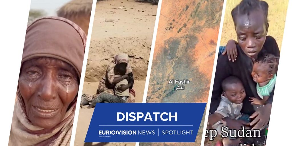
Deutsche Welle’s analysis revealed that a widely shared video purportedly showing a mother and three children cowering before RSF troops was misrepresented. The footage, which predated the fall of el-Fasher by more than a month, actually showed an encounter with Sudanese Armed Forces soldiers who were questioning the woman about possible RSF connections.
More concerning is the emergence of AI-generated content about the conflict. Fact-checkers at VRT and RTVE identified several convincing but entirely fabricated images and videos. One showed a supposed mother and child moments before their execution, while another featured an elderly woman giving emotional testimony. Both were created using AI tools, with one creator even publicly displaying his process for generating such content on social media.
The information vacuum has led some social media users to misinterpret satellite imagery. When news of Yale researchers’ findings spread, users began examining Google Maps, claiming to have found evidence of atrocities across the Sudanese countryside. However, fact-checkers determined that the satellite imagery on Google Maps was months old and that discolorations mistaken for evidence of violence had been present long before the current conflict.
Despite these challenges, legitimate open-source investigation continues to provide valuable insights. BBC Verify authenticated graphic footage showing the aftermath of a massacre at a university building in western el-Fasher, where dozens of bodies were documented.
On November 6, there appeared to be a glimmer of hope when the RSF announced it had agreed to a truce. However, the optimism was short-lived as explosions were reported near the army-controlled capital of Khartoum just a day later, according to AFP.
With limited journalist access, unreliable connectivity, and widespread looting hampering information flow, the international community faces significant challenges in fully understanding and addressing what UN officials have described as one of the world’s most severe humanitarian crises.
Fact Checker
Verify the accuracy of this article using The Disinformation Commission analysis and real-time sources.


8 Comments
It’s heartbreaking to see the graphic satellite evidence of the violence in Sudan. This conflict has been going on for too long without enough international intervention.
Satellite imagery is a powerful tool for documenting the brutal realities of war. I hope this evidence galvanizes the international community to take action in Sudan.
The capture of el-Fasher by the RSF is a major strategic victory, but at what cost to the Sudanese people? This war needs to end before more lives are lost.
Absolutely. The UN must do more to pressure all sides to the negotiating table and find a peaceful resolution to this protracted conflict.
Disturbing satellite evidence of the humanitarian crisis in Sudan. This overlooked conflict deserves much more international attention and intervention to stop the violence.
I agree, the scale of suffering in Sudan is truly devastating. Satellite data is crucial for shedding light on these types of hidden conflicts.
While the conflict in Sudan may be ‘overlooked’, the sheer scale of the humanitarian crisis is staggering. This is a situation that demands urgent global attention and response.
Agreed. The world cannot afford to turn a blind eye to the suffering of the Sudanese people. Concrete steps must be taken to end this devastating civil war.